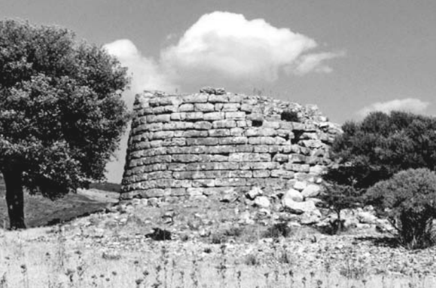
Su Nuraxi di Sisini rises about 200 meters south of the hamlet of the same name in Senorbì, standing out from the flat top of a marly hill (m. 262 a.s.l.) that in the east gradually slopes down to the course of the Riu Piscina Manna. Despite its modest altitude, the position is one of wide dominance and guaranteed the monument control over a vast tabular territory to the west, hilly for the rest, garrisoned on the margins by seven nuraghi strategically placed on the surrounding heights and all in view of each other and with the major nuraghe. The settlement choice, implemented as early as the terminal phases of the Middle Bronze Age (15th-14th centuries B.C.), does not appear accidental or even isolated, considering the pre-existence of a small Chalcolithic village of Monte Claro culture, denounced on the surface by fictile and lithic finds, and the visible remains of dwelling structures outcropping near and at some distance from the prehistoric building, clearly referable to post-Nuragic phases. The discovery of copious clay material from the Nuragic, Punic, Roman and early medieval periods further confirms the multi-layered nature of the settlement. Su Nuraxi has always attracted the attention of scholars because of its alleged planimetric analogy with well temples, apparently consisting of a circular tower to which is grafted, in axis with the entrance, an atrium with diverging rectilinear arms. Recent studies, however, have revealed new architectural details that would seem to place the monument among the group of nuraghi a tancato.


")

